

Sewers and wastewater · DN 100–200
3D sewer survey and lateral survey in Vienna, Lower Austria and Burgenland
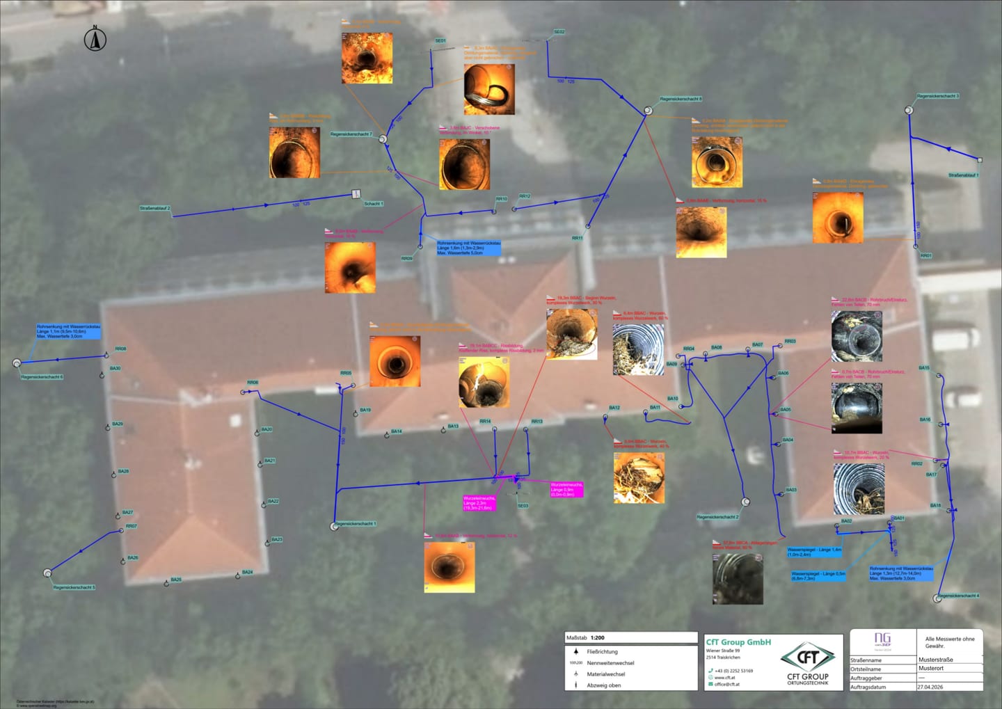
The main run is quickly surveyed – the questions lie in the lateral connections: which connection goes where, which pipe ends blind, what the later extension is actually attached to. The 3D lateral survey drives into every branch with multi-turn steerable camera equipment and in doing so produces a digital representation of the pipe network route. At the end there is a picture of the layout instead of a list of assumptions. We work in Vienna, Lower Austria and Burgenland: a short journey and prompt appointments. Call +43 (0) 2252 53169 or write to office@cft.at, and we will settle access points, nominal diameter and the appointment.

What we do on site
We survey the straight runs of the underground drainage as well as the branches, in a pre-cleaned pipe wherever possible – the branches as far as is technically possible, as a rule up to the base bend. Where the camera head can go no further, the survey ends and we mark the point reached at the surface. You receive the sketch of the route, the still images and the digital representation of the route; it is a model of the route, not a surveyed plan.
Key facts at a glance
| Methods | Multi-turn steerable camera equipment, digital reconstruction of the pipe network route, sonde location in the camera head, electromagnetic pipe locating |
|---|---|
| Application range | DN 100 to DN 200 |
| Duration | Two hours to several days, depending on the number of pipes and laterals |
| Result format | Digital representation of the pipe network route, documented route sketch, still images for each lateral connection, surface marking and, on request, survey by GPS or total station, inspection report |
| Service area | Vienna, Lower Austria and Burgenland |
For you as a private customer
The typical case: cleaning has already been carried out, yet the same pipe blocks again after a few weeks. Or you are planning an extension, a pool, a driveway – and nobody knows which pipes lie underneath. The lateral survey goes where the straight survey run ends: into the branches to the kitchen, the bathroom, the gutter and the yard gully. Afterwards you can see which pipe runs where, where a branch ends blind and where roots or a displacement have established themselves.
The second occasion is the purchase or conversion of an older property. The underground drainage beneath the floor slab is the part of the building services that nobody sees and that no drawing shows in full. Recorded before the conversion work, the sketch settles where something has to be opened up and where it does not.
How the job runs
1. Coordination. We settle which network is to be recorded: the underground drainage beneath the building, the connecting drain as far as the manhole, or the yard drainage as well. We accept existing drawings, but check them against the findings.
2. Pre-survey cleaning. Before the survey we recommend pre-survey jetting of all sewers. Only in a cleaned pipe does the steerable head find the branch opening and avoid getting caught in deposits.
3. Survey run and route recording. The straight runs are surveyed as well as the branches – the branches as far as is technically possible, as a rule up to the base bend. At the same time the digital representation of the route is produced. Notable points are marked at the surface by means of the sonde and, on request, surveyed by GPS or total station.
4. Handover. You receive the route sketch with the associated still images and we go through the route together. Repair and rehabilitation are carried out by your plumber or your pipe rehabilitation contractor.
Equipment and methods
Multi-turn steerable camera equipment
A rigid camera head drives past the lateral connection; a multi-turn steerable head turns in and carries on – over several branches in succession as well. This makes accessible that part of the network which appears only as a dark hole in a normal survey run. Work is carried out from DN 100 to DN 200; where the head cannot get through, the recording ends and this is noted as an end point.
Digital reconstruction of the pipe network route
During the run, the distance travelled is recorded together with changes of direction and gradient, and from this the route of the network is represented digitally. The representation is a route model, not a survey drawing – for positionally accurate points, sonde location and surveying in by GPS or total station are added.
Sonde location and electromagnetic pipe locating
The sonde in the camera head makes the current position detectable at the surface, so that end points and notable features can be marked; for the route as a whole, electromagnetic pipe locating is added. Both react sensitively to reinforcement and services lying in parallel, which is why bearings are cross-checked.
Additional methods when the camera cannot get through
If a section remains impassable – collapsed, obstructed, cut off – the visual recording ends. For such sections, location methods without access to the pipe come into consideration.

What you receive
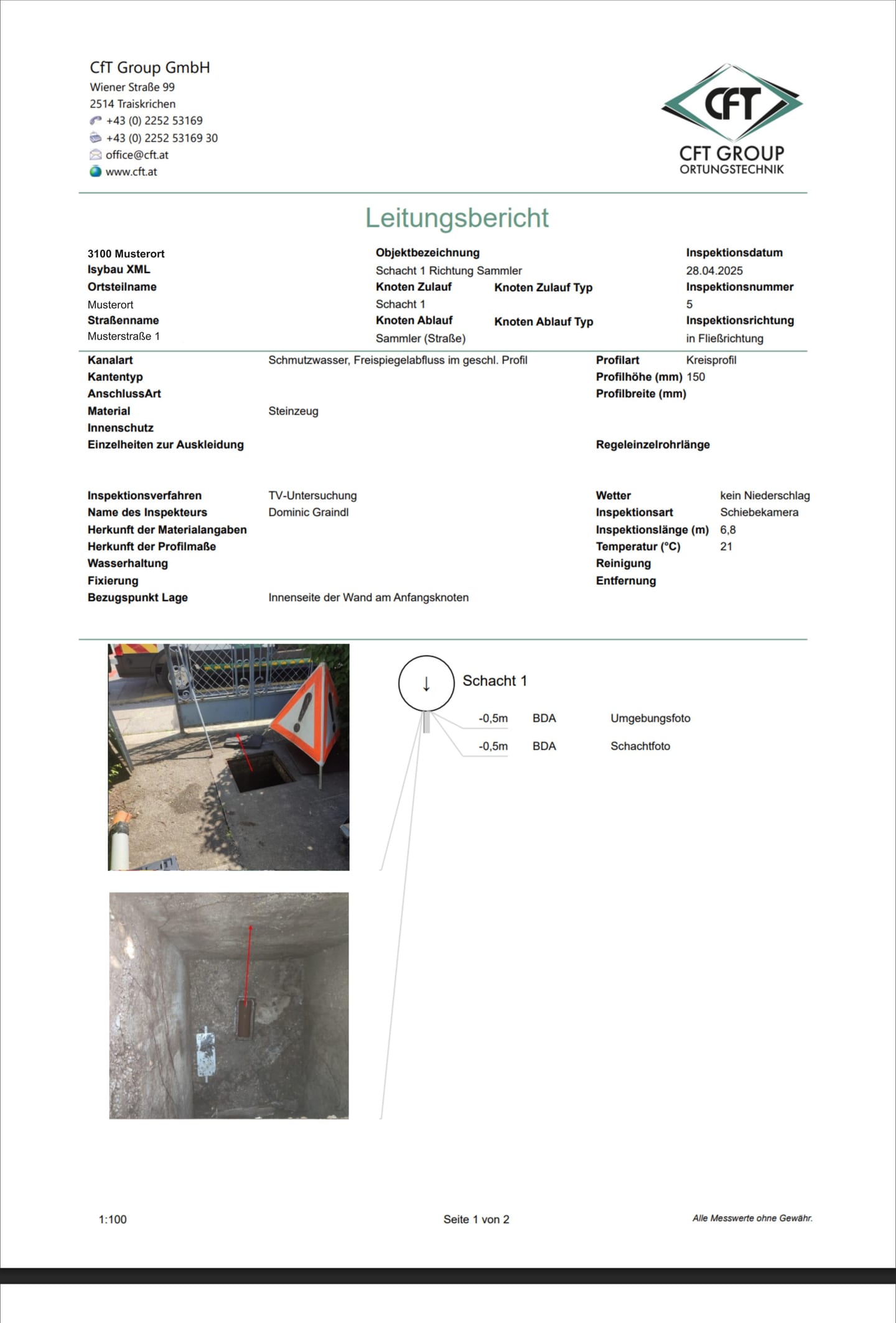
You receive the documented route sketch, the digital representation of the pipe network route and the still images of the lateral connections surveyed, together with the markings at the surface. The inspection report sets down what was noticed in the process: notable features and defects, each with its position along the route. Where a defect lies, we also mark the spot at the surface. From that it can be derived which section is to be opened up and which is not.
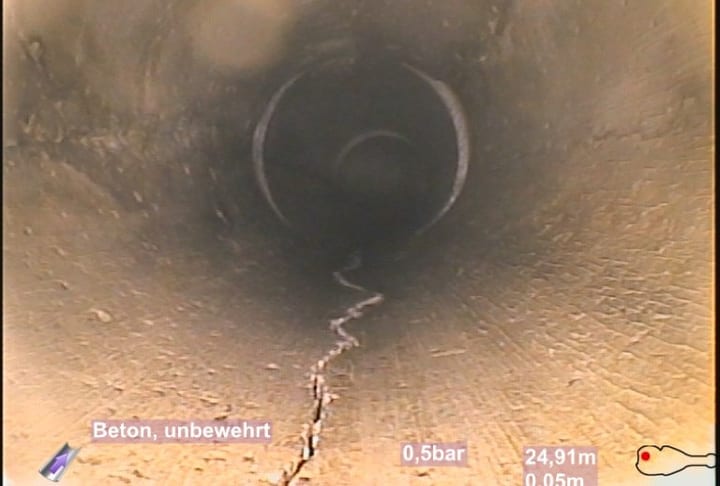
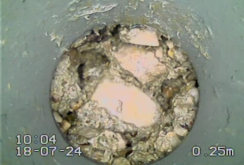
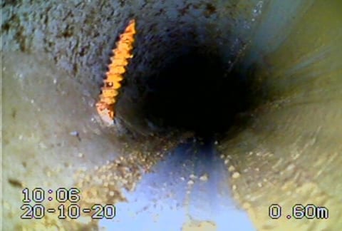
From the archive: what the camera finds.
Three defect images from real sections – each with its station, each coded in the report.
Costs and effort
The effort depends on the number of lateral connections, on the accessibility of the rodding eyes and on whether cleaning is necessary beforehand; we agree the cost range by telephone before the job. If the survey is connected with water damage to the building, buildings insurance as a rule covers the locating costs through the trace and access cover; the record is produced so that it can be submitted to the insurer.
Frequently asked questions
How does this differ from a normal camera survey run?
A normal survey run drives straight through the pipe run and assesses its condition. The 3D lateral survey answers the question of the route: which branches exist and how the network under the house hangs together. In many cases the two complement each other.
What pipe sizes can the steerable head reach?
The application range is DN 100 to DN 200. Below that there is not enough room to turn; above it, crawler cameras with a pan-and-tilt head are as a rule more economical.
How many laterals in a row can be driven?
Several in a row – we do not state a fixed maximum. Where the head can no longer get through, the recording ends; the point reached is noted as an end point and marked at the surface so that work can start there later.
Does the route sketch replace a plan?
It is a reliable basis, but not a surveyed plan. If you need positional accuracy – because work is to be carried out over the route, for instance – we additionally survey in the marked points by GPS or total station. Where satellite reception is not good enough, between house walls or under vegetation, the total station takes that over.
Does cleaning have to be carried out beforehand?
We recommend it. The steerable head needs a clear branch opening; in a clogged pipe the branch remains undetected.
Do you repair the damage at the same time?
No. CFT locates, marks, documents and hands over; the work is carried out by your plumber or your pipe rehabilitation contractor. That is exactly why the sketch and the still images are detailed.
Contact and opening hours
For Vienna, Lower Austria and Burgenland: CFT Group GmbH, Wiener Straße 99, A-2514 Traiskirchen, +43 (0) 2252 53169. Monday to Thursday 8:00–16:30, Friday 8:00–12:00. Outside office hours in writing to office@cft.at, and we will come back to you on the next working day.
Related services
Drain and pipe cleaning
The pre-survey jetting that makes the lateral connections passable in the first place.
Smoke testing and tracer gas
When a branch has been found but it remains unclear where it emerges above ground.
Sewer documentation for older existing property
When no usable drawing of the old building exists any more.
Burst and leak detection in and around buildings
When the question is not the route but the leaking point.
Describe what you are observing.
Just describe what you see – add a photo, and we can often settle on the right method before we even call back.
What happens next
- We read your message and match the case to a method.
- We come back to you – usually with a question that shortens the appointment.
- We confirm the appointment and what it costs before anyone sets off.
Rather talk?
+43 (0) 2252 53169
Mon–Thu 8:00–16:30 · Fri 8:00–12:00
Describe your case.
Fastest by telephone – then we settle straight away which method fits and what you should prepare.
Outside office hours, write to office@cft.at.